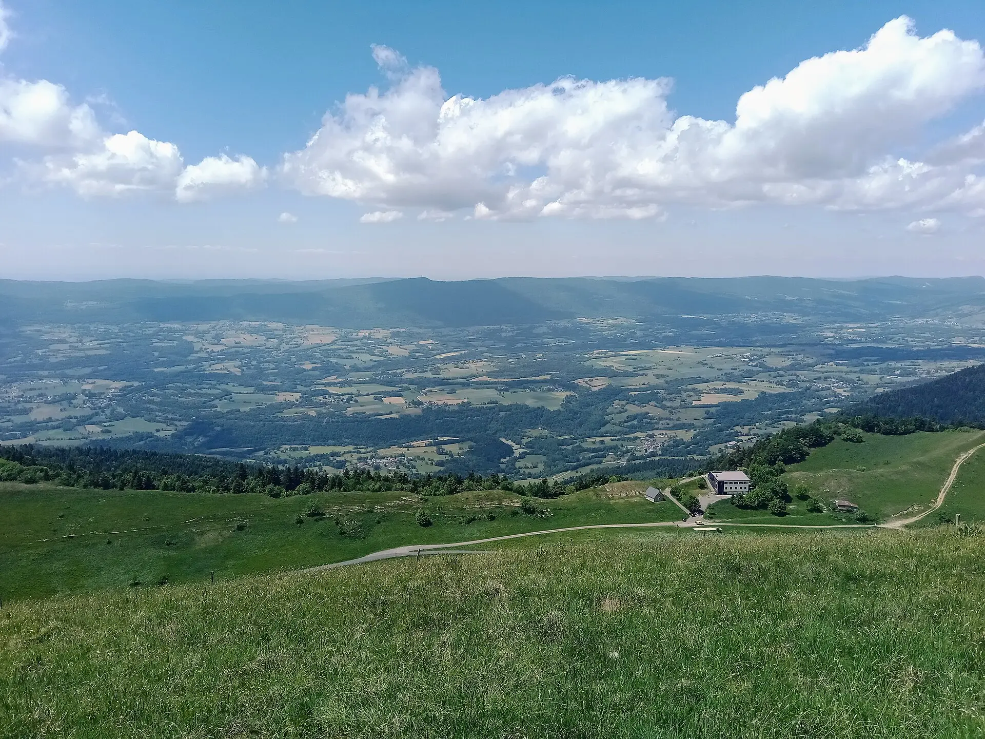

The Valromey occupies the valley of the Séran, between the Haut-Bugey and the Bas-Bugey, north-west of the Grand Colombier. It is one of the four sectors in our guide to Southern Bugey. The area had an identity of its own and became French together with the Bugey under the Treaty of Lyon in 1601. Today its municipalities belong to the Bugey Sud community of communes (a grouping of municipalities that share services) and, for the most part, to the SIVOM du Valromey, a joint local services body.
Villages and merged municipalities
Several mergers have redrawn the map since 2016. In France, neighbouring municipalities can merge into a “new municipality” (commune nouvelle); the former villages often survive as “delegated municipalities” (communes déléguées). The old village names are the ones you see on road signs; the new municipalities are the ones used in postal addresses.
| Municipality | Status | Villages | Page |
|---|---|---|---|
| Champagne-en-Valromey | Municipality | Main village, hamlet of Poisieu | Champagne-en-Valromey (page in French) |
| Valromey-sur-Séran | New municipality (2019) | Belmont-Luthézieu (main seat), Lompnieu, Sutrieu, Vieu | Valromey-sur-Séran (page in French) |
| Arvière-en-Valromey | New municipality (2019) | Virieu-le-Petit (main seat), Chavornay, Brénaz, Lochieu | Arvière-en-Valromey (page in French) |
| Haut Valromey | New municipality (2016, Ruffieu in 2025) | Hotonnes (main seat), Le Grand-Abergement, Le Petit-Abergement, Songieu, Ruffieu | Haut Valromey (page in French) |
| Artemare | Municipality | At the mouth of the Valromey, hamlet of Cerveyrieu | Artemare |
The official INSEE spelling is “Haut Valromey”, without a hyphen; the town hall and the service-public directory also write “Haut-Valromey”. The search “haut valromey” therefore refers both to the municipality and to the upper part of the valley, towards the Retord plateau.
What to see in the Valromey
The Cerveyrieu waterfall
The Séran drops some sixty metres here, in the municipality of Artemare, above the hamlet of Cerveyrieu. The site is an Espace naturel sensible (a protected natural area managed by the Département). Its flow varies a great deal: it can run dry in summer. Swimming and picnicking are prohibited on the banks. For access, the viewpoint from the D31 road and the rules, see our guide to the Cerveyrieu waterfall.
Champagne-en-Valromey
The village has the Maison de Pays du Valromey (media library, games library, advice sessions) on Place Brillat-Savarin, a market on Thursday mornings and a municipal outdoor pool open in summer. The municipality highlights the Pain de Sucre, the Puits des Tines waterfall and the medieval fountain of Poisieu with its pond.
Valromey-sur-Séran
The municipality lists the Adoue chapel, the church at Belmont, the Saint-Maurice chapel and the church at Lompnieu. At Sutrieu, the Lèbe observatory offers a planetarium and observation sessions. The hamlet of Samonod has a goat’s cheese shop, open from May to December.
Arvière-en-Valromey and the Fruitière
At Virieu-le-Petit, the Fruitière du Valromey is a cooperative cheese dairy that makes Comté, tomme, raclette, butter and cream. The site includes a visitor area on cheesemaking, an exhibition room and a shop; guided tours are run on fixed dates with the tourist office. If you are staying in town, the cooperative also has a shop in Belley.
The municipality also mentions the Bugey-Valromey museum, part of the Département’s Patrimoines de l’Ain network, and the former Arvières charterhouse (Carthusian monastery), founded in 1122 on the slopes of the Grand Colombier. The site can be reached on foot by the Sentier des Chartreux trail.
The Grand Colombier from the Valromey side
Two of the four roads up to the pass start in the Valromey, according to the tourist office:
- via Lochieu, from Champagne-en-Valromey: 12.3 km and 900 m of climbing, presented as the least difficult ascent; the office also recommends it for motorhomes and long vehicles;
- via Virieu-le-Petit, from Artemare: 15.9 km, 1,251 m of climbing and a 22% section, the steepest and narrowest, to be avoided in a motorhome.
Details for each side are in our guide to cycling the Grand Colombier. The pass roads are closed in winter by the Ain Département, usually from November to the second half of April.
Where to walk: the best starting points
The tourist office lists walks starting in Arvière-en-Valromey: the Sur Lyand ridges, the Sentier des Chartreux, Chanduraz from Charaillin, the Grand Colombier from Munet and the Hergues ridges. Another starts in Artemare, at the foot of the Grand Colombier. Distances and times are given walk by walk on the office’s website; we do not repeat them without having checked them.
Practical starting points, depending on what you are after:
- Munet (Arvière-en-Valromey) to climb the Grand Colombier on foot; see also hiking on the Grand Colombier;
- Les Bordèzes for the Sentier des Chartreux;
- Champagne-en-Valromey for the Pain de Sucre and Poisieu;
- the Plans d’Hotonnes for routes across the plateau.
In the mountain pastures, wild camping is not allowed and dogs must be kept on a lead because of the herds.
Retord and the Plans d’Hotonnes
To the north, the municipality of Haut Valromey includes the Plans d’Hotonnes resort, the gateway to the Retord plateau, the neighbouring Lachat-Retord area and the Alliettes pond at Songieu. In winter, the cross-country ski area offers more than 150 km of routes across the plateau; the season is announced from 1 December 2026 to 31 March 2027, subject to snow cover. In summer, mountain biking, walking and summer biathlon take over. Everything is covered on our page on the Retord plateau and Plans d’Hotonnes.
Where to eat in the Valromey
The Bugey360 directory lists, in no particular order:
- La Barque, a café-restaurant and shop on Place Brillat-Savarin in Champagne-en-Valromey;
- the Chez Cuzieu farm inn at Munet, serving produce from its organic farm;
- the Auberge de Ruffieu, a family-run inn with rooms;
- the Auberge de la Grange des Plans and the farm table Au rythme du troupeau, on the plateau, by reservation;
- in Artemare, the Le Séran restaurant and the Les Caudalies hotel-restaurant.
Opening hours change with the season: check them on each listing or with the business. For a wider choice, see all restaurants in Southern Bugey.
For local produce, the Pain de la Cascade bakes bread in a wood-fired oven at Chassin, and the Domaine Collomb offers Bugey wine tastings by appointment.
Markets in the Valromey
- Champagne-en-Valromey: Thursday morning, 8 am – 12.30 pm, Place Brillat-Savarin, under a covered shelter (town hall).
- Ruffieu (Haut Valromey): Saturday, 9.30 am – 12 noon, market of local producers and craftspeople (tourist office). The town hall announced its return in spring 2026; the exact season is still to be confirmed.
- The Plans d’Hotonnes: on the second Friday of the month, according to the tourist office, with no location or season specified.
No weekly market is documented in Artemare, Valromey-sur-Séran or Arvière-en-Valromey. The full list is on our page on markets in Southern Bugey (in French).
The Valromey through the seasons
- Spring: the Cerveyrieu waterfall generally carries more water after rain; the Grand Colombier roads reopen in the second half of April.
- Summer: the municipal pool in Champagne-en-Valromey (2026 season: 27 June to 30 August), mountain pastures, pass roads open.
- Autumn: Christmas market season, including those at Songieu (21 November 2026), Artemare in the evening (28 November) and the Fruitière du Valromey (19 December). Dates and times in the events calendar.
- Winter: cross-country skiing and snowshoeing on the Retord plateau, subject to snow; winter tyres or other required winter equipment are compulsory from 1 November to 31 March to reach the resorts.
Getting to the Valromey
Regional coach line A45 links Belley to Champagne-en-Valromey via Virieu-le-Grand, home to Virieu-le-Grand–Belley station. The other villages are not served by any regular line identified in official sources; Arvière-en-Valromey and Artemare refer residents to the CC Bugey Sud’s on-demand transport service. Details in our guide to getting around Southern Bugey.